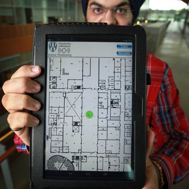
Another school year is just around the corner, and over the coming weeks students of all ages will fill their backpacks, make their way into school, and likely get lost trying to find their way to their classes for the first time, but a few students at the University of Windsor won’t have that problem.
The group, led by 22-year-old electrical and computer engineering student Paramvir Nagpal, along with classmates Mohammad Rahman and Qing Tang, have created The University of Windsor Indoor Positioning System, or UWin IPS for short.
The application can map any indoor space on a mobile device, and utilizes a Wi-Fi signal to plot the user with a green dot, providing directions around the building.
Such IPS applications can also be applied to other large and unfamiliar buildings, like malls, hospitals, museums, and airports. All the developers require is a map with a layout of the building and a Wi-Fi connection, which can detect a user’s position within 10 feet.
Though GPS is currently the preferred method of navigation, GPS signals aren’t powerful enough to penetrate concrete walls, and can’t pinpoint a user’s position within a building, or what floor they are on. In the future IPS systems can be used in tandem with GPS to help users navigate their way directly to their destination within a building.
While the UWin IPS application is not yet ready for market the students have received an A+ on their project, and hope to make those confusing first days of school a little less stressful in years to come.


