Canadian-German satellite operation and imagery group BlackBridge has raised $22 million in funding by the Bank of Montreal (BMO) and the Business Development Bank of Canada (BDC).
BlackBridge is focused on providing end to end solutions across the “geospatial value chain,” or basically the industry that allows people to apply data to specific locations, often tied into satallite imagery. This includes satellite operations, ground station services, data center and geocloud solutions, and worldwide satellite imagery distribution through over 100 BlackBridge partners.
The company has a few large data centres in both Lethbridge, Alberta and in Canada’s north. Along with its focus on satellite, it also offer more general services in colocation, continuity, cloud, and network services.
“We can help by providing attractive service alternatives to improve your IT security and reliability, while keeping the mission critical knowledge of your data and business applications within your company,” wrote the company.
A portion of the new funding will go towards the company’s “RapidEye Mosaics” satellite imagery.
On the new funding, the BDC’s Matthew Kellow called “BlackBridge is a dynamic, growth-oriented, and forward-thinking company that is a great example of the type of company we are looking to partner with over the long-term.” “We are excited about furthering our partnership with the company and the new business opportunities that will result from RapidEye+,” he said.
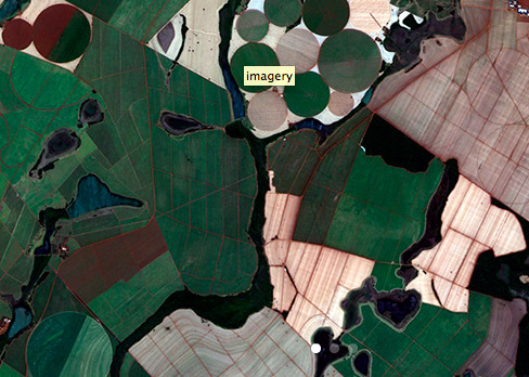
RapidEye Mosaics are the product of a constellation of 5 identical satellites that images over 1 billion km² of the earth every year, with up to 5 million km² collected daily. The RapidEye Mosaic images are geometrically aligned and orthorectifed using highly-accurate ground control, and are uniformly colour-balanced to guarantee a high-quality natural colour image.
Real life applications for RapidEye Mosaics include digital mapping, visual simulation projects, resource and infrastructure monitoring and feature analysis. On its website, BlackBridge shows work its done with RapidEye on agricultural monitoring programs and disaster mapping in Valparaiso, Chile.
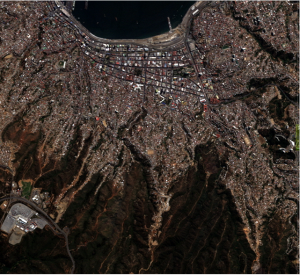
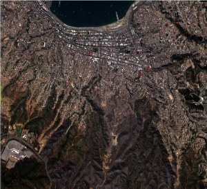
Here’s “before” (April 1) and “after” (April 14) shots of satellite imagery covering Valparaiso. Most notable is some of the increased grayish areas, which depict fire-affected areas.

 The company plans to use the new funding to “contribute to the development of a new satellite constellation that will enhance BlackBridge’s already remarkable imaging prowess, allowing the company to expand its current range of geospatial solutions.”


